Geolocate

Lakeview topographic map

Click on the map to display elevation.

About this map

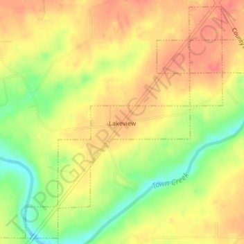
Name: Lakeview topographic map, elevation, terrain.

Location: Lakeview, DeKalb County, Alabama, United States (34.37823 -85.99131 34.40386 -85.96047)

Average elevation: 1,129 ft

Minimum elevation: 1,020 ft

Maximum elevation: 1,194 ft

DeKalb County trails, hiking, mountain biking, running and outdoor activities

Other topographic maps

Click on a map to view its topography, its elevation and its terrain.

Camp Comer Dam

United States > Alabama > DeKalb County

Average elevation: 1,608 ft

Mentone

United States > Alabama > DeKalb County

Mentone is a town in DeKalb County, Alabama, United States. Mentone, located atop Lookout Mountain, has the highest elevation of any incorporated town in Alabama, and narrowly higher than Hytop.

Average elevation: 1,542 ft

Grove Oak

United States > Alabama > DeKalb County

Average elevation: 1,129 ft

Adamsburg

United States > Alabama > DeKalb County

Average elevation: 1,388 ft

Fort Payne

United States > Alabama > DeKalb County > Fort Payne

Average elevation: 1,148 ft

Red Hill

United States > Alabama > DeKalb County

Average elevation: 837 ft

Collinsville

United States > Alabama > DeKalb County > Collinsville

Average elevation: 935 ft

Minvale

United States > Alabama > DeKalb County > Fort Payne > Minvale

Average elevation: 1,056 ft

Gear up for your next adventure:

🪄Magnetic Compass - Accurate compass for navigation
🔭Telescopic Hiking Pole - Adjustable pole for hiking stability
🛏️Cold Weather Sleeping Bag - Warm sleeping bag for cold conditions
🧭Outdoor Navigation Book - Learn advanced navigation skills
🛌Ultralight Sleeping Bags - Compact down bags for cold nights in the wilderness

As an Amazon Associate, this site earns from qualifying purchases at no extra cost to you.