Geolocate

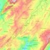
Paya topographic map

Click on the map to display elevation.

About this map

Name: Paya topographic map, elevation, terrain.

Location: Paya, La Libertad, Boyacá, RAP (Especial) Central, 151820, Colombia (5.50602 -72.51846 5.80029 -72.25487)

Average elevation: 4,268 ft

Minimum elevation: 909 ft

Maximum elevation: 9,042 ft

Other topographic maps

Click on a map to view its topography, its elevation and its terrain.

Santa Domingo

Colombia > Boyacá > Coper

Average elevation: 3,720 ft

Tunja

Colombia > Boyacá > Tunja

Tunja has a population of 172,548 inhabitants according to the 2018 Census. 0.1% of the city is indigenous, 0.4% is black, and 99.5% is white and Mestizo. It is located in central Colombia, at an elevation ranging from approximately 2,700 metres (8,900 ft) to 2,900 metres (9,500 ft). The city centre is at an…

Average elevation: 9,265 ft

Maripí

Colombia > Boyacá > Maripí

Average elevation: 4,508 ft

Guanica Molina

Colombia > Boyacá > Garagoa

Average elevation: 6,253 ft

Sogamoso

Colombia > Boyacá > Sogamoso

Sogamoso (Spanish pronunciation: [soɣaˈmoso]) is a city in the department of Boyacá of Colombia. It is the capital of the Sugamuxi Province, named after the original Sugamuxi. Sogamoso is nicknamed "City of the Sun", based on the original Muisca tradition of pilgrimage and adoring their Sun god Sué at the…

Average elevation: 9,518 ft

Río Upía

Colombia > Boyacá > Aquitania

Average elevation: 10,427 ft

El Cocuy

Colombia > Boyacá > El Cocuy > El Cocuy

Average elevation: 9,117 ft

Soatá

Colombia > Boyacá > Soatá

Average elevation: 6,795 ft

Cañaveral

Colombia > Boyacá > Socotá

Average elevation: 11,329 ft

Belén

Colombia > Boyacá > Belén

Average elevation: 9,347 ft

Cordillera Oriental

Colombia > Boyacá > Güicán

The Cordillera Oriental montane forests ecoregion covers the eastern slopes of the cordillera and its northern end. The Magdalena Valley montane forests cover the western slopes. The Northern Andean páramo covers the highest elevations.

Average elevation: 15,830 ft

Casco Urbano

Colombia > Boyacá

Average elevation: 9,180 ft

Maco

Colombia > Boyacá > Paya

Average elevation: 3,993 ft

Gear up for your next adventure:

🎒Day Hiking Backpack - Lightweight backpack perfect for day trips and outdoor adventures
📻Weather Alert Radios - Stay informed of storm risks while off-the-grid
🏕️Tent Footprint - Protect your tent base from wear
🎁Geography Themed Gifts - Unique gift ideas for map lovers and geography enthusiasts
🧭Compass with Lanyard - Easy‑carry compass for navigation

As an Amazon Associate, this site earns from qualifying purchases at no extra cost to you.