
清新区 topographic map
Interactive map
Click on the map to display elevation.
About this map
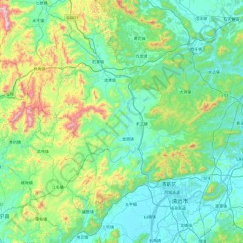
Name: 清新区 topographic map, elevation, terrain.
Location: 清新区, 清远市, 广东省, 中国 (23.54780 112.56313 24.31856 113.10660)
Average elevation: 846 ft
Minimum elevation: 10 ft
Maximum elevation: 4,583 ft
Other topographic maps
Click on a map to view its topography, its elevation and its terrain.