Geolocate

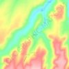
Ryan Dam topographic map

Click on the map to display elevation.

About this map

Name: Ryan Dam topographic map, elevation, terrain.

Location: Ryan Dam, Cascade County, Montana, United States (47.56755 -111.12594 47.57031 -111.12212)

Average elevation: 3,219 ft

Minimum elevation: 2,884 ft

Maximum elevation: 3,392 ft

Other topographic maps

Click on a map to view its topography, its elevation and its terrain.

Great Falls

United States > Montana > Cascade County

Average elevation: 3,445 ft

Stockett

United States > Montana > Cascade County

Average elevation: 3,816 ft

Vaughn

United States > Montana > Cascade County

Average elevation: 3,392 ft

Ulm

United States > Montana > Cascade County

Average elevation: 3,432 ft

Great Falls

United States > Montana > Cascade County > Great Falls

Average elevation: 3,520 ft

Hardy

United States > Montana > Cascade County

Average elevation: 3,701 ft

Great Falls

United States > Montana > Cascade County

Average elevation: 3,445 ft

Black Eagle

United States > Montana > Cascade County

Average elevation: 3,432 ft

Gear up for your next adventure:

🧭Hiking Compass - Precision compass for reliable navigation in the wilderness
🪄Magnetic Compass - Accurate compass for navigation
🛏️Cold Weather Sleeping Bag - Warm sleeping bag for cold conditions
🔥Plasma Lighters - Windproof lighters that work in any weather condition
❄️Traction Cleats - Prevent slips on icy trails during winter hikes

As an Amazon Associate, this site earns from qualifying purchases at no extra cost to you.