Geolocate

Hi Hat topographic map

Click on the map to display elevation.

About this map

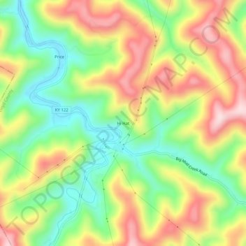
Name: Hi Hat topographic map, elevation, terrain.

Location: Hi Hat, Floyd County, Kentucky, 41636, United States (37.37177 -82.74905 37.41177 -82.70905)

Average elevation: 1,257 ft

Minimum elevation: 748 ft

Maximum elevation: 1,854 ft

Floyd County trails, hiking, mountain biking, running and outdoor activities

Other topographic maps

Click on a map to view its topography, its elevation and its terrain.

Wheelwright

United States > Kentucky > Floyd County

Average elevation: 1,460 ft

Allen

United States > Kentucky > Floyd County

Average elevation: 856 ft

Martin

United States > Kentucky > Floyd County

Average elevation: 883 ft

Gear up for your next adventure:

🔥Plasma Lighters - Windproof lighters that work in any weather condition
🥾Women's Hiking Boots - Top-rated trail boots with ankle support and superior grip
🧭Map Reading Tools - Tools and kits for map navigation
📦Dry Bags Set - Waterproof storage for electronics and clothes
🛠️Backpacking Tool Kit - Essential toolkit for outdoor repairs

As an Amazon Associate, this site earns from qualifying purchases at no extra cost to you.