Geolocate

Pangarchulla topographic map

Click on the map to display elevation.

About this map

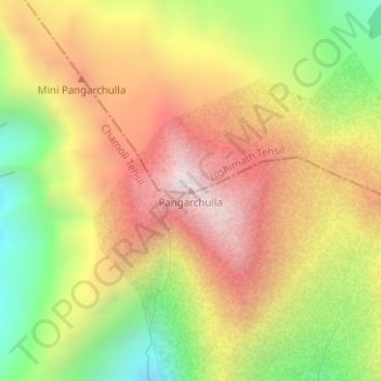
Name: Pangarchulla topographic map, elevation, terrain.

Location: Pangarchulla, Joshimath Tehsil, Chamoli, Uttarakhand, 246483, India (30.42362 79.59209 30.42372 79.59219)

Average elevation: 13,323 ft

Minimum elevation: 11,463 ft

Maximum elevation: 14,993 ft

Other topographic maps

Click on a map to view its topography, its elevation and its terrain.

Saraswati

India > Uttarakhand > Joshimath Tehsil > Mana

Average elevation: 17,694 ft

Mana

India > Uttarakhand > Joshimath Tehsil

Average elevation: 16,270 ft

Hemkund

India > Uttarakhand > Joshimath Tehsil

Average elevation: 14,327 ft

Hemkund

India > Uttarakhand > Joshimath Tehsil

Average elevation: 14,327 ft

Gear up for your next adventure:

📡GPS Antenna Upgrade - Enhance GPS reception in remote terrain
🧭Outdoor Navigation Book - Learn advanced navigation skills
🗻Climbing Gear Basics - Essential gear for beginner climbers
🛰️Satellite Messengers - Emergency SOS and two-way messaging for off-grid adventures
📚Navigation Handbooks - Master the art of reading topographic maps and using a compass

As an Amazon Associate, this site earns from qualifying purchases at no extra cost to you.