
Puducherry topographic map
Click on the map to display elevation.
About this map
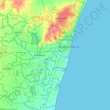
Name: Puducherry topographic map, elevation, terrain.
Location: Puducherry, India (11.77523 79.59942 12.05098 79.87460)
Average elevation: 39 ft
Minimum elevation: -13 ft
Maximum elevation: 207 ft
Other topographic maps
Click on a map to view its topography, its elevation and its terrain.
Puducherry
India > Puducherry > Puducherry Taluk
The topography of Pondicherry is the same as that of coastal Tamil Nadu. Pondicherry's average elevation is at sea level and includes a number of sea inlets, referred to locally as "backwaters". Pondicherry experiences extreme coastal erosion as a result of a breakwater constructed in 1989, just to the south…
Average elevation: 33 ft