
南城街道 topographic map
Interactive map
Click on the map to display elevation.
About this map
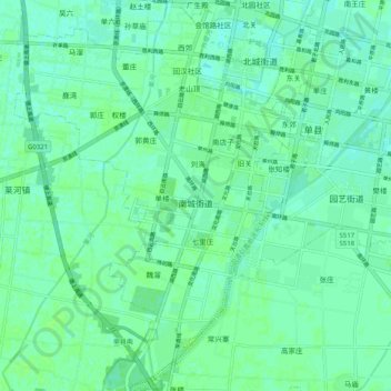
Name: 南城街道 topographic map, elevation, terrain.
Location: 南城街道, 单县, 菏泽市, 山东省, 274300, 中国 (34.72501 116.02375 34.80782 116.09607)
Average elevation: 148 ft
Minimum elevation: 135 ft
Maximum elevation: 157 ft
Other topographic maps
Click on a map to view its topography, its elevation and its terrain.