
Hour topographic map
Click on the map to display elevation.
About this map
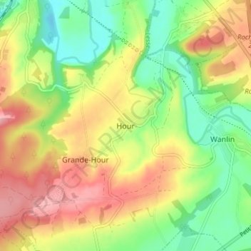
Name: Hour topographic map, elevation, terrain.
Location: Hour, Houyet, Dinant, Namur, Wallonia, 5563, Belgium (50.14131 5.01724 50.18131 5.05724)
Average elevation: 551 ft
Minimum elevation: 364 ft
Maximum elevation: 758 ft
Other topographic maps
Click on a map to view its topography, its elevation and its terrain.