
Dinant topographic map
Click on the map to display elevation.
About this map
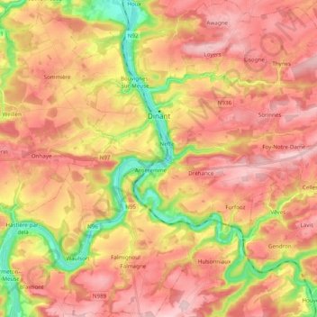
Name: Dinant topographic map, elevation, terrain.
Location: Dinant, Namur, Wallonia, Belgium (50.18024 4.85443 50.30468 5.04792)
Average elevation: 689 ft
Minimum elevation: 249 ft
Maximum elevation: 988 ft
Other topographic maps
Click on a map to view its topography, its elevation and its terrain.