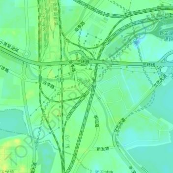
Geolocate

巡司河 topographic map

Interactive map

Click on the map to display elevation.

About this map

Name: 巡司河 topographic map, elevation, terrain.

Location: 巡司河, 洪山街道, 洪山区, 武汉市, 湖北省, 中国 (30.44920 114.30076 30.46445 114.30953)

Average elevation: 72 ft

Minimum elevation: 46 ft

Maximum elevation: 102 ft

Other topographic maps

Click on a map to view its topography, its elevation and its terrain.

星湖

中国 > 湖北省 > 洪山区

星湖, 武汉大学信息学部, 珞南街道, 洪山区, 武汉市, 湖北省, 中国

Average elevation: 135 ft

天兴洲

中国 > 湖北省 > 洪山区

天兴洲, 洪山区, 武汉市, 湖北省, 中国

Average elevation: 79 ft

左岭街道

中国 > 湖北省 > 洪山区

左岭街道, 东湖新技术开发区(托管), 洪山区, 武汉市, 湖北省, 中国

Average elevation: 98 ft

张家湾

中国 > 湖北省 > 洪山区

张家湾, 洪山区, 武汉市, 湖北省, 中国

Average elevation: 72 ft

严西湖

中国 > 湖北省 > 洪山区

严西湖, 洪山区, 武汉市, 湖北省, 中国

Average elevation: 89 ft