
Whispering Hills topographic map
Click on the map to display elevation.
About this map
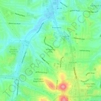
Name: Whispering Hills topographic map, elevation, terrain.
Average elevation: 607 ft
Minimum elevation: 492 ft
Maximum elevation: 860 ft
Other topographic maps
Click on a map to view its topography, its elevation and its terrain.
J. Percy Priest Lake
United States > Tennessee > Davidson County > Nashville
Average elevation: 554 ft
Edwin Warner Park
United States > Tennessee > Davidson County > Nashville > Devonshire Manor
Average elevation: 650 ft
Harpeth River Greenway
United States > Tennessee > Davidson County > Nashville > Harpeth River Estates
Average elevation: 597 ft
Ellington Agricultural Center
United States > Tennessee > Davidson County > Nashville
Average elevation: 584 ft
Tennessee State Capitol
United States > Tennessee > Davidson County > Nashville
Average elevation: 456 ft