Geolocate

Oak Level topographic map

Click on the map to display elevation.

About this map

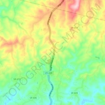
Name: Oak Level topographic map, elevation, terrain.

Location: Oak Level, Henry County, Virginia, United States (36.75847 -79.96593 36.82286 -79.91654)

Average elevation: 1,073 ft

Minimum elevation: 774 ft

Maximum elevation: 1,522 ft

Henry County trails, hiking, mountain biking, running and outdoor activities

Other topographic maps

Click on a map to view its topography, its elevation and its terrain.

Spencer

United States > Virginia > Henry County

Average elevation: 889 ft

Leatherwood

United States > Virginia > Henry County

Average elevation: 883 ft

Collinsville

United States > Virginia > Henry County

Average elevation: 876 ft

Horse Pasture

United States > Virginia > Henry County

Average elevation: 1,043 ft

Philpott

United States > Virginia > Henry County

Average elevation: 981 ft

Davis Store

United States > Virginia > Henry County

Average elevation: 919 ft

Axton

United States > Virginia > Henry County

Average elevation: 928 ft

Robertson Mountain

United States > Virginia > Henry County

Average elevation: 991 ft

Gear up for your next adventure:

🧭Orienteering Set - Complete compass and map reading kit
🔭Telescopic Hiking Pole - Adjustable pole for hiking stability
🥾Women's Hiking Boots - Top-rated trail boots with ankle support and superior grip
🌡️Handheld Weather Meters - Measure wind, temp, and pressure for safe mountain travel
🧺Microfiber Travel Towels - Compact and fast-drying towels for trail use

As an Amazon Associate, this site earns from qualifying purchases at no extra cost to you.