
Fairfield Glade topographic map
Interactive map
Click on the map to display elevation.
About this map
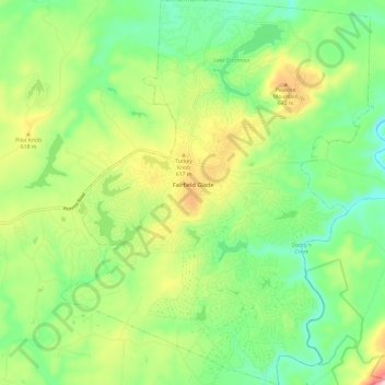
Name: Fairfield Glade topographic map, elevation, terrain.
Average elevation: 1,778 ft
Minimum elevation: 1,394 ft
Maximum elevation: 2,497 ft
Cumberland County trails, hiking, mountain biking, running and outdoor activities
Other topographic maps
Click on a map to view its topography, its elevation and its terrain.
Grassland Addition
United States > Tennessee > Cumberland County > Crossville
Average elevation: 1,837 ft