
Terrell Hills topographic map
Interactive map
Click on the map to display elevation.
About this map
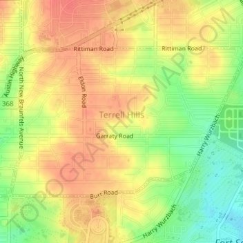
Name: Terrell Hills topographic map, elevation, terrain.
Location: Terrell Hills, Bexar County, Texas, United States (29.46820 -98.46070 29.48478 -98.43027)
Average elevation: 764 ft
Minimum elevation: 659 ft
Maximum elevation: 827 ft
Bexar County trails, hiking, mountain biking, running and outdoor activities
Other topographic maps
Click on a map to view its topography, its elevation and its terrain.