
Kensington topographic map
Interactive map
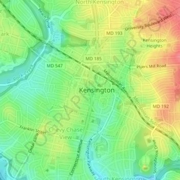
Click on the map to display elevation.
About this map
Name: Kensington topographic map, elevation, terrain.
Average elevation: 312 ft
Minimum elevation: 217 ft
Maximum elevation: 443 ft
Montgomery County trails, hiking, mountain biking, running and outdoor activities
Other topographic maps
Click on a map to view its topography, its elevation and its terrain.
Damascus
United States > Maryland > Montgomery County
As an unincorporated area, Damascus' boundaries are not officially defined. Damascus is recognized by the United States Census Bureau as a census-designated place, and by the United States Geological Survey as a populated place located at 39°16′16″N 77°12′22″W / 39.27111°N 77.20611°W /…
Average elevation: 669 ft
Quail Ridge
United States > Maryland > Montgomery County > Montgomery Village
Average elevation: 436 ft
Seneca
United States > Maryland > Montgomery County > Darnestown
Seneca is located close to the intersection of River Road (Maryland Route 190), Seneca Road (Maryland route 112), and Rileys Lock Road, east of Great Seneca Creek and north of the Potomac River. The C&O Canal runs along the river, and Riley's Lock is the closest canal lock. The southern portion of Seneca Creek…
Average elevation: 269 ft
Great Falls
United States > Maryland > Montgomery County > Potomac
The rocks of the falls date to the late Precambrian and are about 750 million years old. The rocks are a resistant metamorphized schist, gneisses, metagraywackes, and metaconglomerates. The Falls formed the last time sea level dropped, during the Last Glacial Period about 35,000 years ago, causing the Potomac…
Average elevation: 240 ft
Garrett Park Estates
United States > Maryland > Montgomery County > Garrett Park Estates
Average elevation: 318 ft
Brookeville Heights
United States > Maryland > Montgomery County > Brookeville Heights
Average elevation: 456 ft
Rockcrest
United States > Maryland > Montgomery County > Rockville > Rockcrest
Average elevation: 374 ft