
Glendale topographic map
Interactive map
Click on the map to display elevation.
About this map
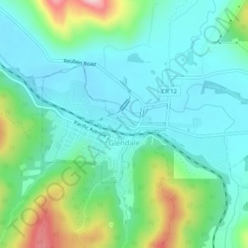
Name: Glendale topographic map, elevation, terrain.
Location: Glendale, Douglas County, Oregon, 97442, United States (42.73185 -123.43581 42.74463 -123.41727)
Average elevation: 1,568 ft
Minimum elevation: 1,368 ft
Maximum elevation: 2,178 ft
Douglas County trails, hiking, mountain biking, running and outdoor activities
Other topographic maps
Click on a map to view its topography, its elevation and its terrain.