
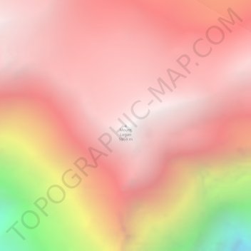
Mount Logan topographic map
Interactive map
Click on the map to display elevation.
Mount Logan
Due to active tectonic uplifting, Mount Logan is still rising in height (approximately 0.35 mm per year). Before 1992, the exact elevation of Mount Logan was unknown and measurements ranged from 5,959 to 6,050 metres (19,551 to 19,849 ft). In May 1992, a GSC expedition climbed Mount Logan and fixed the current height of 5,959 metres (19,551 ft) using GPS.
About this map
Name: Mount Logan topographic map, elevation, terrain.
Location: Mount Logan, Yukon, Canada (60.56780 -140.40574 60.56790 -140.40564)
Average elevation: 17,362 ft
Minimum elevation: 11,991 ft
Maximum elevation: 19,498 ft
Other topographic maps
Click on a map to view its topography, its elevation and its terrain.
Dawson City
The community is at an elevation of 320 m (1,050 ft) and the average rainfall in July is 49.0 mm (1.93 in) and the average snowfall in January is 27.6 cm (10.87 in). Dawson has an average total annual snowfall of 166.5 cm (65.55 in) and averages 70 frost free days per year. The town is built on a layer of…
Average elevation: 1,663 ft