
Mayo-Sava topographic map
Interactive map
Click on the map to display elevation.
About this map
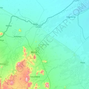
Name: Mayo-Sava topographic map, elevation, terrain.
Location: Mayo-Sava, Far-North, Cameroon (10.77966 13.87535 11.42654 14.50094)
Average elevation: 1,276 ft
Minimum elevation: 988 ft
Maximum elevation: 3,589 ft
Other topographic maps
Click on a map to view its topography, its elevation and its terrain.