
Bluefield topographic map
Interactive map
Click on the map to display elevation.
About this map
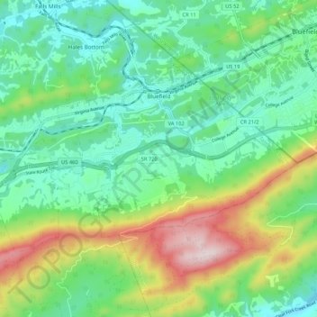
Name: Bluefield topographic map, elevation, terrain.
Location: Bluefield, Tazewell County, Virginia, 24605, United States (37.21100 -81.33100 37.26085 -81.22510)
Average elevation: 2,785 ft
Minimum elevation: 2,215 ft
Maximum elevation: 4,098 ft
Tazewell County trails, hiking, mountain biking, running and outdoor activities
Other topographic maps
Click on a map to view its topography, its elevation and its terrain.
Lamberts Store
United States > Virginia > Tazewell County > Lamberts Store
Average elevation: 2,356 ft