
Castle Rock topographic map
Interactive map
Click on the map to display elevation.
Castle Rock
Castle Rock is located at 39°22′20″N 104°51′22″W / 39.37222°N 104.85611°W / 39.37222; -104.85611 (39.372212, −104.856090) at an elevation of 6,224 feet (1,897 m). Castle Rock is in central Colorado at the junction of Interstate 25 and State Highway 86, 28 mi (45 km) south of downtown Denver and 37 mi (60 km) north of Colorado Springs.
About this map
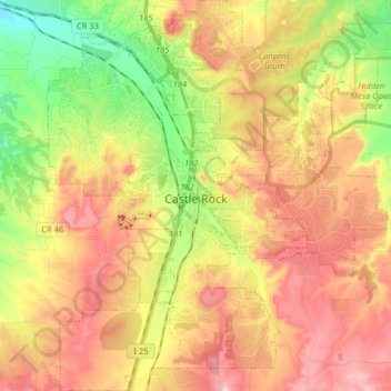
Name: Castle Rock topographic map, elevation, terrain.
Location: Castle Rock, Douglas County, Colorado, United States (39.31127 -104.91980 39.43495 -104.76130)
Average elevation: 6,404 ft
Minimum elevation: 5,850 ft
Maximum elevation: 6,942 ft
Douglas County trails, hiking, mountain biking, running and outdoor activities
Other topographic maps
Click on a map to view its topography, its elevation and its terrain.
Hidden Mesa Open Space
United States > Colorado > Douglas County > Castle Rock
Average elevation: 6,240 ft