
Berthoud topographic map
Interactive map
Click on the map to display elevation.
About this map
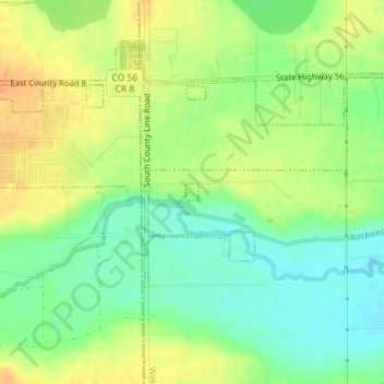
Name: Berthoud topographic map, elevation, terrain.
Location: Berthoud, Weld County, Colorado, United States (40.29694 -105.05158 40.29816 -105.05037)
Average elevation: 4,964 ft
Minimum elevation: 4,905 ft
Maximum elevation: 5,020 ft
Weld County trails, hiking, mountain biking, running and outdoor activities
Other topographic maps
Click on a map to view its topography, its elevation and its terrain.
Pawnee National Grassland
United States > Colorado > Weld County
The grassland is a part of the short grass plains of North America. The best example of this ecosystem are preserved around the Pawnee Buttes where grazing and intensive agriculture have had less impact. There are eleven vegetation zones represented with the most unique being the scarp woodlands on the north…
Average elevation: 4,954 ft
Greeley
United States > Colorado > Weld County > Greeley > Greeley
Greeley experiences a semi-arid climate (Köppen BSk). High temperatures are generally around 90–95 °F (32 °C) in the summer and 40-45 °F (4 °C) in the winter, although significant variation occurs. The hottest days generally occur around the third week of July and the coldest in January. Nighttime lows…
Average elevation: 4,783 ft