
Oakland topographic map
Interactive map
Click on the map to display elevation.
About this map
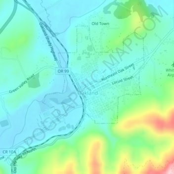
Name: Oakland topographic map, elevation, terrain.
Location: Oakland, Douglas County, Oregon, United States (43.41348 -123.31139 43.43252 -123.28622)
Average elevation: 564 ft
Minimum elevation: 397 ft
Maximum elevation: 1,138 ft
Douglas County trails, hiking, mountain biking, running and outdoor activities
Other topographic maps
Click on a map to view its topography, its elevation and its terrain.