
Giza topographic map
Interactive map
Click on the map to display elevation.
About this map
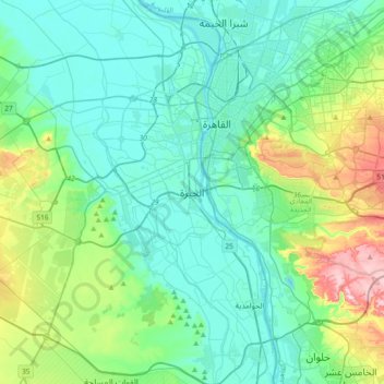
Name: Giza topographic map, elevation, terrain.
Location: Giza, 12524, Egypt (29.82708 31.05181 30.14708 31.37181)
Average elevation: 236 ft
Minimum elevation: 20 ft
Maximum elevation: 1,083 ft
Other topographic maps
Click on a map to view its topography, its elevation and its terrain.