
Buffalo Springs topographic map
Interactive map
Click on the map to display elevation.
About this map
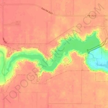
Name: Buffalo Springs topographic map, elevation, terrain.
Location: Buffalo Springs, Lubbock County, Texas, United States (33.52025 -101.72842 33.54562 -101.68580)
Average elevation: 3,110 ft
Minimum elevation: 2,943 ft
Maximum elevation: 3,156 ft
Lubbock County trails, hiking, mountain biking, running and outdoor activities
Other topographic maps
Click on a map to view its topography, its elevation and its terrain.
Buffalo Springs Lake Dam
United States > Texas > Lubbock County > Buffalo Springs
Average elevation: 3,081 ft
Shallowater
United States > Texas > Lubbock County > Shallowater > Shallowater
Average elevation: 3,310 ft