
Truro topographic map
Interactive map
Click on the map to display elevation.
About this map
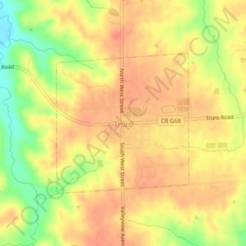
Name: Truro topographic map, elevation, terrain.
Location: Truro, Madison County, Iowa, United States (41.20211 -93.85639 41.21750 -93.83705)
Average elevation: 1,056 ft
Minimum elevation: 935 ft
Maximum elevation: 1,122 ft
Other topographic maps
Click on a map to view its topography, its elevation and its terrain.
Winterset
United States > Iowa > Madison County > Winterset
Winterset, Madison County, Iowa, United States
Average elevation: 1,079 ft
Patterson
United States > Iowa > Madison County > Patterson > Patterson
Patterson, Madison County, Iowa, 50218, United States
Average elevation: 945 ft
Patterson
United States > Iowa > Madison County
Patterson, Madison County, Iowa, 50218, United States
Average elevation: 928 ft
Bevington
United States > Iowa > Madison County
Bevington, Madison County, Iowa, 50033, United States
Average elevation: 879 ft