
Christiansburg topographic map
Interactive map
Click on the map to display elevation.
About this map
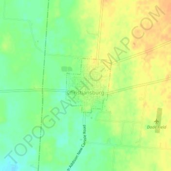
Name: Christiansburg topographic map, elevation, terrain.
Location: Christiansburg, Champaign County, Ohio, 45389, United States (40.05212 -84.03011 40.06073 -84.02075)
Average elevation: 1,122 ft
Minimum elevation: 1,066 ft
Maximum elevation: 1,171 ft
Champaign County trails, hiking, mountain biking, running and outdoor activities
Other topographic maps
Click on a map to view its topography, its elevation and its terrain.