Geolocate

Grad Ivanec topographic maps

Click on a map to view its topography, its elevation and its terrain.
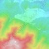
Prigorec

Croatia > Varaždin County > Grad Ivanec

Average elevation: 1,791 ft

Gear up for your next adventure:

🗺️NatGeo Topo Maps - High-quality waterproof printed topographic maps of US Parks
🔦Compact Flashlight - Reliable flashlight for emergencies
🥩Freeze-Dried Meals - Nutritious and lightweight food for remote expeditions
🧭Outdoor Navigation Book - Learn advanced navigation skills
🪓Survival Multi‑Tool - Versatile tool for camp and trail tasks

As an Amazon Associate, this site earns from qualifying purchases at no extra cost to you.