
扶隆镇 topographic map
Interactive map
Click on the map to display elevation.
About this map
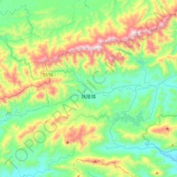
Name: 扶隆镇 topographic map, elevation, terrain.
Location: 扶隆镇, 防城区, 防城港市, 广西壮族自治区, 中国 (21.74495 107.81985 21.90889 108.09271)
Average elevation: 1,378 ft
Minimum elevation: 72 ft
Maximum elevation: 4,419 ft
Other topographic maps
Click on a map to view its topography, its elevation and its terrain.