
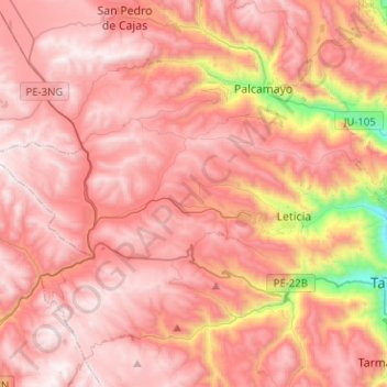
La Unión topographic map
Interactive map
Click on the map to display elevation.
About this map
Name: La Unión topographic map, elevation, terrain.
Location: La Unión, Province of Tarma, Junín, Peru (-11.40318 -75.96019 -11.32149 -75.70734)
Average elevation: 13,241 ft
Minimum elevation: 9,865 ft
Maximum elevation: 14,836 ft
Other topographic maps
Click on a map to view its topography, its elevation and its terrain.
Barrio Independencia
Barrio Independencia, San José de Quero, Province of Concepción, Junín, Peru
Average elevation: 13,081 ft
Chanchamayo
Peru > Junín > Santo Domingo de Acobamba > Chanchamayo
Chanchamayo, Santo Domingo de Acobamba, Province of Huancayo, Junín, Peru
Average elevation: 8,471 ft
Carhuamayo
Peru > Junín > Carhuamayo
Carhuamayo, Province of Junín, Junín, Peru
Average elevation: 13,937 ft