Geolocate

Palomas topographic map

Click on the map to display elevation.

About this map

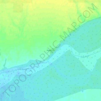
Name: Palomas topographic map, elevation, terrain.

Location: Palomas, Yuma County, Arizona, United States (32.88894 -113.50130 32.92894 -113.46130)

Average elevation: 410 ft

Minimum elevation: 384 ft

Maximum elevation: 446 ft

Yuma County trails, hiking, mountain biking, running and outdoor activities

Other topographic maps

Click on a map to view its topography, its elevation and its terrain.

Yuma

United States > Arizona > Yuma County

Average elevation: 256 ft

Tuscan Ranch

United States > Arizona > Yuma County > Yuma

Average elevation: 207 ft

Fortuna Foothills

United States > Arizona > Yuma County

Average elevation: 436 ft

Somerton

United States > Arizona > Yuma County

Average elevation: 108 ft

Gear up for your next adventure:

🥘Titanium Cookware - Durable, featherlight pots and pans for backpacking
🌐World Map Poster - Decorative world maps with topographic info
🪄Magnetic Compass - Accurate compass for navigation
🔥Camping Stove - Portable stove for camping and backcountry cooking
🌡️Portable Weather Meter - Track weather conditions on the trail

As an Amazon Associate, this site earns from qualifying purchases at no extra cost to you.