Geolocate

Tangi topographic map

Click on the map to display elevation.

About this map

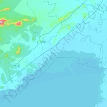
Name: Tangi topographic map, elevation, terrain.

Location: Tangi, Khordha, Odisha, India (19.79990 85.26697 19.98837 85.57208)

Average elevation: 75 ft

Minimum elevation: 0 ft

Maximum elevation: 1,988 ft

Other topographic maps

Click on a map to view its topography, its elevation and its terrain.

Attabira

India > Odisha > Attabira

Average elevation: 531 ft

Panikoili

India > Odisha > Panikoili

Average elevation: 66 ft

Bhuban

India > Odisha > Bhuban

Bhuban is located at 20°53′N 85°50′E / 20.88°N 85.83°E / 20.88; 85.83. It has an average elevation of 64 metres (209 feet). As of 2011 India census, Bhuban had a population of 22,200. Males constitute 52% of the population and females 48%. Bhuban has an average literacy rate of 75%, just…

Average elevation: 151 ft

Hemagiri

India > Odisha > Hemgir

Average elevation: 1,175 ft

Baliapal

India > Odisha > Baliapal

Average elevation: 20 ft

Jagatpur

India > Odisha > Cuttack (M.Corp.) P.S

Average elevation: 79 ft

Khurdha Municipality Boundary

India > Odisha > Khordha

Average elevation: 194 ft

Janla

India > Odisha > Jatani

Average elevation: 102 ft

Belpahar

India > Odisha > Belpahar

Average elevation: 774 ft

Dungripali

India > Odisha > Dunguripali

Average elevation: 522 ft

Paradip

India > Odisha > Paradeep Lock

Average elevation: 10 ft

Karanjia

India > Odisha > Karanjia

Average elevation: 1,286 ft

Dhuria

India > Odisha > Kendrapara Sadar

Average elevation: 23 ft

Dhenkanal

India > Odisha > Dhenkanal Sadar

Average elevation: 322 ft

Talcher

India > Odisha > Colliery

Average elevation: 276 ft

Bhadrak

India > Odisha > Bhadrak Rural

Average elevation: 49 ft

Sarbahal

India > Odisha > Jharsuguda

Average elevation: 715 ft

Bhubaneshwar

India > Odisha > Bhubaneswar (M.Corp.)

Bhubaneswar is in Khordha district of Odisha. It is in the eastern coastal plains, along the axis of the Eastern Ghats mountains. The city has an average altitude of 45 m (148 ft) above sea level. It lies southwest of the Mahanadi River that forms the northern boundary of Bhubaneswar metropolitan area, within…

Average elevation: 98 ft

Mangalpur

India > Odisha > Pipili

Average elevation: 30 ft

Anandpur

India > Odisha > Anandapur

Average elevation: 141 ft

Chandeswar

India > Odisha > Tangi

Average elevation: 59 ft

Balasore

India > Odisha > Balasore

Average elevation: 46 ft

Uttara

India > Odisha > Uttara P.S

Average elevation: 52 ft

Puri

India > Odisha > Puri (M)

Average elevation: 20 ft

Ambapua

India > Odisha > Brahmapur (M.Corp.) > Ambapua

Average elevation: 66 ft

Mahasingha

India > Odisha > Baliguda > Mahasingha

Average elevation: 1,827 ft

Nabarangapur

India > Odisha > Nabarangapur P.S

Average elevation: 1,886 ft

Kotapad

India > Odisha > Kotpad

Average elevation: 1,827 ft

Soro

India > Odisha > Soro

Average elevation: 46 ft

Gear up for your next adventure:

📚Navigation Handbooks - Master the art of reading topographic maps and using a compass
🌲Outdoor Survival Books - Best books on survival skills
🧴Hand Sanitizer - Keep hands clean while hiking
📡Handheld GPS Device - Reliable handheld GPS for outdoor navigation
GPS Sports Watch - GPS watch for running, hiking and training

As an Amazon Associate, this site earns from qualifying purchases at no extra cost to you.