
Pinewood Lake topographic map
Click on the map to display elevation.
About this map
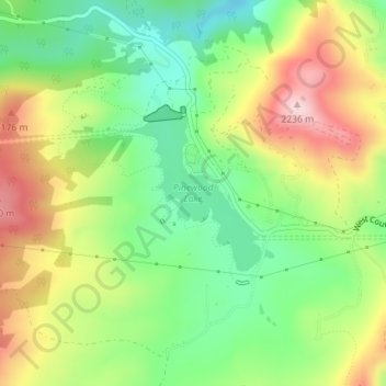
Name: Pinewood Lake topographic map, elevation, terrain.
Location: Pinewood Lake, Larimer County, Colorado, United States (40.35718 -105.29187 40.36813 -105.27857)
Average elevation: 6,778 ft
Minimum elevation: 6,371 ft
Maximum elevation: 7,323 ft
Larimer County trails, hiking, mountain biking, running and outdoor activities
Other topographic maps
Click on a map to view its topography, its elevation and its terrain.
Estes Park
United States > Colorado > Larimer County > Estes Park > Estes Park
Average elevation: 8,074 ft
Hallett Peak
United States > Colorado > Larimer County
According to the Köppen climate classification system, Hallett Peak is located in an alpine subarctic climate zone with cold, snowy winters, and cool to warm summers. Due to its altitude, it receives precipitation all year, as snow in winter and as thunderstorms in summer, with a dry period in late spring.
Average elevation: 11,736 ft
Rawah Wilderness
United States > Colorado > Larimer County
The Rawah Wilderness is administered by the USDA Forest Service. It is located on the Canyon Lakes Ranger District of the Roosevelt National Forest in Colorado, near the Wyoming border, and also in the Routt National Forest to its south. It encompasses 76,394 acres (309.16 km2) and includes 25 named lakes…
Average elevation: 9,508 ft
Browns Corner
United States > Colorado > Larimer County > Loveland > Browns Corner
Average elevation: 4,980 ft
Neota Wilderness
United States > Colorado > Larimer County
The Neota Wilderness is administered by the USDA Forest Service. It is located on the Canyon Lakes Ranger District of the Roosevelt National Forest in Colorado. This wilderness area encompasses 9,924 acres (40 km2) and is bordered on the south by Rocky Mountain National Park. Elevation ranges from 10,000 ft…
Average elevation: 10,676 ft