
鹤山市 topographic map
Interactive map
Click on the map to display elevation.
About this map
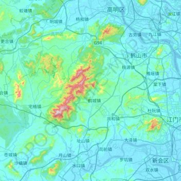
Name: 鹤山市 topographic map, elevation, terrain.
Location: 鹤山市, 江门市, 广东省, 中国 (22.46938 112.47137 22.85927 113.04413)
Average elevation: 187 ft
Minimum elevation: -13 ft
Maximum elevation: 2,556 ft
Other topographic maps
Click on a map to view its topography, its elevation and its terrain.