
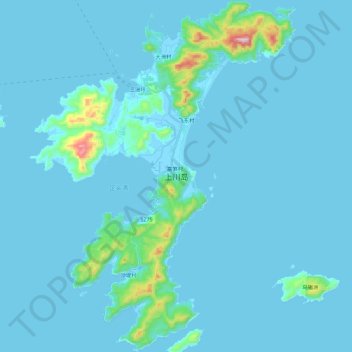
上川岛 topographic map
Interactive map
Click on the map to display elevation.
About this map
Name: 上川岛 topographic map, elevation, terrain.
Location: 上川岛, 江门市, 广东省, 中国 (21.56821 112.70056 21.77855 112.87261)
Average elevation: 89 ft
Minimum elevation: -20 ft
Maximum elevation: 1,529 ft
Other topographic maps
Click on a map to view its topography, its elevation and its terrain.