
恩平市 topographic map
Interactive map
Click on the map to display elevation.
About this map
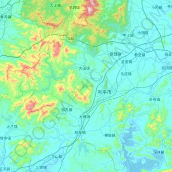
Name: 恩平市 topographic map, elevation, terrain.
Location: 恩平市, 江门市, 广东省, 中国 (21.91693 111.99833 22.49499 112.52407)
Average elevation: 436 ft
Minimum elevation: -16 ft
Maximum elevation: 3,986 ft
Other topographic maps
Click on a map to view its topography, its elevation and its terrain.