
下川岛 topographic map
Interactive map
Click on the map to display elevation.
About this map
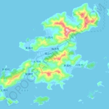
Name: 下川岛 topographic map, elevation, terrain.
Location: 下川岛, 江门市, 广东省, 中国 (21.58826 112.51987 21.71791 112.66472)
Average elevation: 131 ft
Minimum elevation: -20 ft
Maximum elevation: 1,722 ft
Other topographic maps
Click on a map to view its topography, its elevation and its terrain.