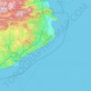
Navarre topographic map
Click on the map to display elevation.
Navarre
Despite its relatively small size, Navarre features stark contrasts in geography, from the Pyrenees mountain range that dominates the territory to the plains of the Ebro river valley in the south. The highest point in Navarre is Mesa de los Tres Reyes, with an elevation of 2,428 metres (7,965 feet).
About this map

Name: Navarre topographic map, elevation, terrain.
Location: Navarre, Spain (41.90989 -2.49994 43.31495 -0.72334)
Average elevation: 2,064 ft
Minimum elevation: -3 ft
Maximum elevation: 7,034 ft
Other topographic maps
Click on a map to view its topography, its elevation and its terrain.


Playa Bonita
Spain > Andalusia > Costa del Sol Occidental > La Perla-Torremuelle > Santana
Average elevation: 138 ft






Vigo
Vigo has a transitional climate between the oceanic climate "Cfb" and the warm-summer Mediterranean climate "Csb" according to the Köppen climate classification. Although Vigo is the rainiest city in Galicia, with its noticeable drying trend in the summer, Vigo's climate is more similar to the variant of the…
Average elevation: 397 ft
Pyrenees
The Pyrenees (/ˈpɪrɪniːz/; Spanish: Pirineos [piɾiˈneos]; French: Pyrénées [piʁene] (listen); Catalan: Pirineu [piɾiˈnɛw]; Basque: Pirinioak [piɾini.o.ak]; Occitan: Pirenèus [piɾeˈnɛws]; Aragonese: Pirineus) is a mountain range straddling the border of France and Spain. It extends nearly 500…
Average elevation: 1,611 ft

Pyrenees
The Pyrenees is a mountain range in southwestern Europe, straddling the France–Spain border. The Pyrenees extend nearly 500 kilometres (310 mi) from their union with the Cantabrian Mountains to Cap de Creus on the Mediterranean coast, reaching a maximum elevation of 3,404 metres (11,168 ft) at the peak of…
Average elevation: 1,870 ft




La Marina
Spain > Valencian Community > el Baix Segura / La Vega Baja > Guardamar del Segura
Average elevation: 23 ft

Pyrenees
The Pyrenees (/ˈpɪrɪniːz/; Spanish: Pirineos [piɾiˈneos]; French: Pyrénées [piʁene] (listen); Catalan: Pirineu [piɾiˈnɛw]; Basque: Pirinioak [piɾini.o.ak]; Occitan: Pirenèus [piɾeˈnɛws]; Aragonese: Pirineus) is a mountain range straddling the border of France and Spain. It extends nearly 500…
Average elevation: 1,611 ft


Picos de Europa
The Picos de Europa ("Peaks of Europe", also the Picos) are a mountain range extending for about 20 km (12 mi), forming part of the Cantabrian Mountains in northern Spain. The range is situated in the Autonomous Communities of Asturias, Cantabria and Castile and León. The highest peak is Torre de Cerredo, at…
Average elevation: 7,513 ft

Serra d'Aitana
Spain > Valencian Community > la Marina Baixa > Benifato
The most spectacular part of the trail is the Font de Partagás - Pas de la rabossa - Summit of Aitana with a distance of 2 km. It starts at 1040 meters elevation, with almost 500 meters of uneven terrain. The path is well signposted with trail markings and distance signs.
Average elevation: 2,743 ft

Alhambra
Spain > Andalusia > Comarca de la Vega de Granada > Granada
During the reign of the Nasrid Dynasty, the Alhambra was transformed into a palatine city, complete with an irrigation system composed of aqueducts and water channels that provided water for the complex and for other nearby countryside palaces such as the Generalife. Previously, the old fortresses on the hill…
Average elevation: 2,490 ft

Quintanilla del Rebollar
Spain > Castile and León > Merindad de Sotoscueva
Average elevation: 2,621 ft



Cerro de la Florosa
Spain > Andalusia > Comarca de la Costa Granadina > Los Guájares
Average elevation: 3,025 ft


San Nicolás Viewpoint
Spain > Andalusia > Comarca de la Vega de Granada > Granada
Average elevation: 2,493 ft
Santiago de Compostela
The cathedral borders the main plaza of the old and well-preserved city. According to medieval legend, the remains of the apostle James were brought to Galicia for burial; in 813, the light of a bright star guided a shepherd who was watching his flock at night to the burial site in Santiago de Compostela. This…
Average elevation: 814 ft

Picos de Europa
The Picos de Europa ("Peaks of Europe", also the Picos) are a mountain range extending for about 20 km (12 mi), forming part of the Cantabrian Mountains in northern Spain. The range is situated in the Autonomous Communities of Asturias, Cantabria and Castile and León. The highest peak is Torre de Cerredo, at…
Average elevation: 7,513 ft







Parque Municipal Villafranco del Guadiana
Spain > Extremadura > Badajoz > Villafranco del Guadiana
Average elevation: 607 ft


Urbanització Galatzó
Spain > Balearic Islands > Serra de Tramuntana > Calvià
Average elevation: 164 ft




Soportújar
Spain > Andalusia > Comarca de la Alpujarra Granadina > Soportújar
Average elevation: 3,438 ft