
Winsted topographic map
Click on the map to display elevation.
About this map
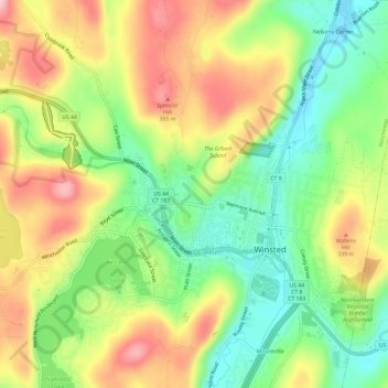
Name: Winsted topographic map, elevation, terrain.
Average elevation: 925 ft
Minimum elevation: 627 ft
Maximum elevation: 1,280 ft
Northwest Hills Planning Region trails, hiking, mountain biking, running and outdoor activities
Other topographic maps
Click on a map to view its topography, its elevation and its terrain.
Browns Corner
United States > Connecticut > Northwest Hills Planning Region > New Hartford
Average elevation: 696 ft
Apple Hill
United States > Connecticut > Northwest Hills Planning Region > Morris
Average elevation: 974 ft
Winchester Center
United States > Connecticut > Northwest Hills Planning Region > Winchester
Average elevation: 1,263 ft
Northfield
United States > Connecticut > Northwest Hills Planning Region > Litchfield
Average elevation: 850 ft
Bakerville
United States > Connecticut > Northwest Hills Planning Region > New Hartford
Average elevation: 801 ft
Haystack Mountain
United States > Connecticut > Northwest Hills Planning Region > Norfolk
Average elevation: 1,263 ft
Marble Dale
United States > Connecticut > Northwest Hills Planning Region > Washington
Average elevation: 817 ft
Washington Depot
United States > Connecticut > Northwest Hills Planning Region > Washington
Average elevation: 758 ft
Nelsons Corner
United States > Connecticut > Northwest Hills Planning Region > Winchester
Average elevation: 902 ft
Nepaug
United States > Connecticut > Northwest Hills Planning Region > New Hartford
Average elevation: 728 ft
West Torrington
United States > Connecticut > Northwest Hills Planning Region > Torrington
Average elevation: 886 ft
Canaan Valley
United States > Connecticut > Northwest Hills Planning Region > North Canaan
Average elevation: 961 ft
Lakeville
United States > Connecticut > Northwest Hills Planning Region > Salisbury
Average elevation: 850 ft
Roxbury Falls
United States > Connecticut > Northwest Hills Planning Region > Roxbury
Average elevation: 492 ft
East Morris
United States > Connecticut > Northwest Hills Planning Region > Morris
Average elevation: 965 ft
Wangum Village
United States > Connecticut > Northwest Hills Planning Region > Canaan
Average elevation: 771 ft
Pleasant Valley
United States > Connecticut > Northwest Hills Planning Region > Barkhamsted
Average elevation: 630 ft
Drakeville
United States > Connecticut > Northwest Hills Planning Region > Torrington
Average elevation: 1,014 ft
Lookout
United States > Connecticut > Northwest Hills Planning Region > Goshen
Average elevation: 1,424 ft
Bartholomew Hill
United States > Connecticut > Northwest Hills Planning Region > Goshen
Average elevation: 1,398 ft
Taconic
United States > Connecticut > Northwest Hills Planning Region > Salisbury
Average elevation: 784 ft
Yellow Mountain
United States > Connecticut > Northwest Hills Planning Region > New Hartford
Average elevation: 732 ft
Bear Mountain
United States > Connecticut > Northwest Hills Planning Region > Salisbury
Bear Mountain is a peak of the southern Taconic Mountains in Salisbury, Connecticut. At 2,316 feet (706 m) (note, per references 1 and 3, there is disagreement about the precise elevation), Bear Mountain is the highest mountain that lies wholly within Connecticut. However, it is not the state highpoint: in the…
Average elevation: 1,785 ft
The Matterhorn
United States > Connecticut > Northwest Hills Planning Region > Canaan
Average elevation: 1,516 ft
Bear Mountain
United States > Connecticut > Northwest Hills Planning Region > Salisbury
Bear Mountain is a peak of the southern Taconic Mountains in Salisbury, Connecticut. At 2,316 feet (706 m) (note, per references 1 and 3, there is disagreement about the precise elevation), Bear Mountain is the highest mountain that lies wholly within Connecticut. However, it is not the state highpoint: in the…
Average elevation: 1,785 ft
Torringford
United States > Connecticut > Northwest Hills Planning Region > Torrington
Average elevation: 988 ft
The Matterhorn
United States > Connecticut > Northwest Hills Planning Region > Canaan
Average elevation: 1,516 ft
Lime Rock
United States > Connecticut > Northwest Hills Planning Region > Salisbury
Average elevation: 781 ft
Apple Hill
United States > Connecticut > Northwest Hills Planning Region > Morris
Average elevation: 974 ft
Bulls Bridge
United States > Connecticut > Northwest Hills Planning Region > Kent
Average elevation: 584 ft
Bear Mountain
United States > Connecticut > Northwest Hills Planning Region > Salisbury
Bear Mountain is a peak of the southern Taconic Mountains in Salisbury, Connecticut. At 2,316 feet (706 m) (note, per references 1 and 3, there is disagreement about the precise elevation), Bear Mountain is the highest mountain that lies wholly within Connecticut. However, it is not the state highpoint: in the…
Average elevation: 1,785 ft
Grand Staircase
United States > Connecticut > Northwest Hills Planning Region > Kent
Average elevation: 673 ft
Northfield
United States > Connecticut > Northwest Hills Planning Region > Litchfield
Average elevation: 850 ft
Bradford Mountain
United States > Connecticut > Northwest Hills Planning Region > Canaan
Average elevation: 1,542 ft
Panorama Hill
United States > Connecticut > Northwest Hills Planning Region > Colebrook
Average elevation: 1,243 ft
Canaan Valley
United States > Connecticut > Northwest Hills Planning Region > North Canaan
Average elevation: 961 ft
Milton Hill
United States > Connecticut > Northwest Hills Planning Region > Goshen
Average elevation: 1,207 ft
Town Hill
United States > Connecticut > Northwest Hills Planning Region > New Hartford
Average elevation: 837 ft
Northfield
United States > Connecticut > Northwest Hills Planning Region > Litchfield
Average elevation: 850 ft
Burrville
United States > Connecticut > Northwest Hills Planning Region > Torrington
Average elevation: 958 ft