
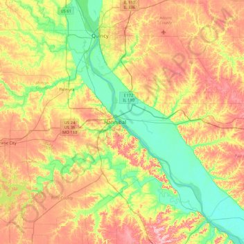
Pearl Island topographic map
Interactive map
Click on the map to display elevation.
About this map
Name: Pearl Island topographic map, elevation, terrain.
Location: Pearl Island, Pike County, Illinois, 63401, USA (39.38671 -91.65487 40.02671 -91.01487)
Average elevation: 633 ft
Minimum elevation: 433 ft
Maximum elevation: 915 ft
Other topographic maps
Click on a map to view its topography, its elevation and its terrain.
Northbrook
USA > Illinois > Northbrook
Northbrook, Cook County, Illinois, 60062, USA
Average elevation: 659 ft
Douglas Park
USA > Illinois > Douglas Park
Douglas Park, Whiteside County, Illinois, 61037, USA
Average elevation: 646 ft
Garfield Ridge
Garfield Ridge, Chicago, Cook County, Illinois, USA
Average elevation: 604 ft
Montague Island
Montague Island, Rockford, Winnebago County, Illinois, 61104, USA
Average elevation: 833 ft