Geolocate

Wilson topographic map

Click on the map to display elevation.

About this map

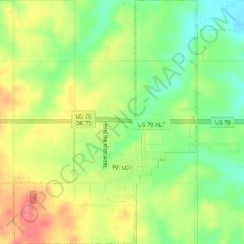
Name: Wilson topographic map, elevation, terrain.

Location: Wilson, Carter County, Oklahoma, 73463, United States (34.14377 -97.45725 34.20185 -97.40458)

Average elevation: 938 ft

Minimum elevation: 833 ft

Maximum elevation: 1,070 ft

Carter County trails, hiking, mountain biking, running and outdoor activities

Other topographic maps

Click on a map to view its topography, its elevation and its terrain.

Graham

United States > Oklahoma > Carter County

Average elevation: 942 ft

Tussy

United States > Oklahoma > Carter County

Average elevation: 974 ft

Fox

United States > Oklahoma > Carter County

Average elevation: 981 ft

Milo

United States > Oklahoma > Carter County

Average elevation: 906 ft

Pooleville

United States > Oklahoma > Carter County

Average elevation: 1,043 ft

Gear up for your next adventure:

🎒Gear Packing Cubes - Organize your backpack efficiently
👟Men's Trail Runners - Lightweight footwear for fast-paced exploration and light hiking
🥇GPS Hiking Watch - Multi‑sport GPS watch with navigation and trail tracking
🥘Titanium Cookware - Durable, featherlight pots and pans for backpacking
📱Solar Portable Charger - Solar power bank for charging devices off‑grid

As an Amazon Associate, this site earns from qualifying purchases at no extra cost to you.