
Gainesville topographic map
Click on the map to display elevation.
About this map
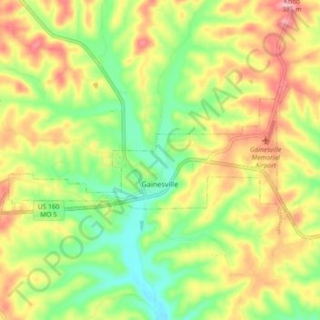
Name: Gainesville topographic map, elevation, terrain.
Location: Gainesville, Ozark County, Missouri, 65655, United States (36.59274 -92.47579 36.62338 -92.39320)
Average elevation: 919 ft
Minimum elevation: 702 ft
Maximum elevation: 1,165 ft
Ozark County trails, hiking, mountain biking, running and outdoor activities
Other topographic maps
Click on a map to view its topography, its elevation and its terrain.