
Hebira topographic map
Interactive map
Click on the map to display elevation.
About this map
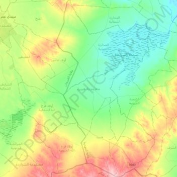
Name: Hebira topographic map, elevation, terrain.
Location: Hebira, Mahdia, Tunisie (35.13032 10.16056 35.42468 10.37680)
Average elevation: 348 ft
Minimum elevation: 151 ft
Maximum elevation: 764 ft
Other topographic maps
Click on a map to view its topography, its elevation and its terrain.