
Ksour Essaf topographic map
Interactive map
Click on the map to display elevation.
About this map
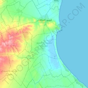
Name: Ksour Essaf topographic map, elevation, terrain.
Location: Ksour Essaf, Mahdia, Tunisie (35.24884 10.86633 35.46409 11.07572)
Average elevation: 72 ft
Minimum elevation: -10 ft
Maximum elevation: 341 ft
Other topographic maps
Click on a map to view its topography, its elevation and its terrain.