
Chorbane topographic map
Interactive map
Click on the map to display elevation.
About this map
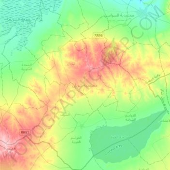
Name: Chorbane topographic map, elevation, terrain.
Location: Chorbane, Mahdia, 5130, Tunisie (35.08891 10.26946 35.36461 10.59201)
Average elevation: 341 ft
Minimum elevation: 125 ft
Maximum elevation: 768 ft
Other topographic maps
Click on a map to view its topography, its elevation and its terrain.