Geolocate

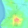
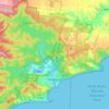
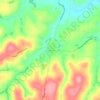
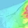
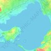
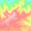
Lake Victoria topographic map

Click on the map to display elevation.

About this map

Name: Lake Victoria topographic map, elevation, terrain.

Location: Lake Victoria, Point Lonsdale, Victoria, 3225, Australia (-38.27731 144.57858 -38.26880 144.60501)

Average elevation: 16 ft

Minimum elevation: -3 ft

Maximum elevation: 79 ft

Other topographic maps

Click on a map to view its topography, its elevation and its terrain.
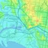
City of Melbourne

Australia > Victoria

Melbourne's topography is characterized by a diverse landscape that transitions from flat coastal plains to rolling hills and mountainous regions. The city is situated at the northern end of Port Phillip Bay, where the terrain is predominantly flat, facilitating urban development. As one moves eastward, the…

Average elevation: 59 ft
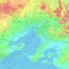
Melbourne

Australia > Victoria

Melbourne is also prone to isolated convective showers forming when a cold pool crosses the state, especially if there is considerable daytime heating. These showers are often heavy and can include hail, squalls, and significant drops in temperature, but they often pass through very quickly with a rapid…

Average elevation: 607 ft
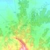
Melbourne

Australia > Victoria

Melbourne is also prone to isolated convective showers forming when a cold pool crosses the state, especially if there is considerable daytime heating. These showers are often heavy and can include hail, squalls, and significant drops in temperature, but they often pass through very quickly with a rapid…

Average elevation: 607 ft
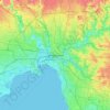
Bendigo

Australia > Victoria

Average elevation: 732 ft

Melbourne

Australia > Victoria

Melbourne is also prone to isolated convective showers forming when a cold pool crosses the state, especially if there is considerable daytime heating. These showers are often heavy and can include hail, squalls, and significant drops in temperature, but they often pass through very quickly with a rapid…

Average elevation: 161 ft
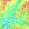
Castlemaine

Australia > Victoria

The Castlemaine goldfields' legendary prosperity raised expectations of Castlemaine becoming Victoria's second city. That is reflected in imposing buildings erected in the town's first few years. Though the rich alluvial diggings were largely exhausted within 15–20 years causing the town's population to…

Average elevation: 1,047 ft
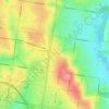
Glen Waverley

Australia > Victoria

Average elevation: 338 ft

Aireys Inlet

Australia > Victoria > Aireys Inlet

Average elevation: 52 ft

Endeavour Hills

Australia > Victoria

Average elevation: 223 ft

Geelong

Australia > Victoria

Average elevation: 138 ft

Shepparton

Australia > Victoria

Average elevation: 381 ft

Western Port

Australia > Victoria

Formerly a major river drainage system, it was inundated together with Port Phillip by the rising sea in the Holocene period; the Western Port sunkland now forms an extensive tidal bay. The waters of Western Port cover an area of 680 km² of which 270 km² are exposed as mud flats at low tide. The topography…

Average elevation: 115 ft

Templestowe

Australia > Victoria > Melbourne

Gentle, rolling hills extend from east of the Yarra River flood plains, along Templestowe Road (towards the Eastern Freeway) for seven km (4.3 miles), to the north-east. The altitude of the plain above sea level is 50 m, and the topography is subdued and mostly flat; the hills are just below 60 m, the slopes…

Average elevation: 217 ft

Foster North

Australia > Victoria

Average elevation: 591 ft

Murchison North

Australia > Victoria

Average elevation: 397 ft

Ballarat

Australia > Victoria

Ballarat has a moderate oceanic climate (Köppen climate classification Cfb) with four distinct seasons. Its elevation, ranging between 400 and 630 metres (1,310 and 2,070 feet) above sea level, causes its mean monthly temperatures to tend to be on average 3 to 5 °C (5 to 9 °F) below those of Melbourne,…

Average elevation: 1,542 ft
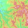
Mount Buller

Australia > Victoria

Due to its far south-western location in the alpine region, Mount Buller is more susceptible to cold airmasses which allow it to record some of the lowest maximum temperatures and daytime readings in the country, despite being considerably lower in elevation than other mountain sites to the north-east. On 5…

Average elevation: 2,703 ft

Ferntree Gully District

Australia > Victoria

Average elevation: 302 ft

Kyneton

Australia > Victoria

Average elevation: 1,654 ft

Williamstown

Australia > Victoria > Melbourne

Average elevation: 13 ft

Mount Evelyn

Australia > Victoria

Average elevation: 620 ft

Great Otway National Park

Australia > Victoria

Average elevation: 299 ft

Strathbogie

Australia > Victoria

Average elevation: 1,667 ft

Coronet Bay

Australia > Victoria

Average elevation: 43 ft

Noradjuha

Australia > Victoria

Average elevation: 492 ft

Noble Park North

Australia > Victoria

Average elevation: 210 ft

Lake Hume

Australia > Victoria > Tallangatta

Average elevation: 945 ft

Cowes

Australia > Victoria

Average elevation: 89 ft

Cockatoo

Australia > Victoria

Average elevation: 761 ft

Moe

Australia > Victoria

Average elevation: 259 ft

Anglesea

Australia > Victoria

Average elevation: 197 ft

Upper Ferntree Gully

Australia > Victoria

Average elevation: 581 ft

Portland

Australia > Victoria

Average elevation: 66 ft

Colac

Australia > Victoria

Average elevation: 417 ft

Shepparton

Australia > Victoria

Average elevation: 374 ft

Sandy Point

Australia > Victoria

Average elevation: 13 ft

Wangaratta

Australia > Victoria

Average elevation: 486 ft

Wandong

Australia > Victoria

Average elevation: 1,224 ft

City of Greater Shepparton

Australia > Victoria

Average elevation: 420 ft

Lara

Australia > Victoria

Average elevation: 82 ft

Hepburn

Australia > Victoria

Average elevation: 1,562 ft

Thorpdale

Australia > Victoria

Average elevation: 909 ft

Dereel

Australia > Victoria

Average elevation: 1,112 ft

Narbethong

Australia > Victoria

Average elevation: 1,814 ft

Camberwell

Australia > Victoria > Melbourne

The Prospect Hill Road Precinct area is adjacent to the railway station and is the oldest part of the suburb. The original subdivision was relatively generous blocks, which were quickly filled with fine Victorian and Edwardian houses. Due to its hilly topography, many east–west streets in the Prospect Hill…

Average elevation: 217 ft

Keysborough

Australia > Victoria

Average elevation: 49 ft

Grampians National Park

Australia > Victoria

Mount William is known within the gliding community for the "Grampians Wave", a weather phenomenon that sometimes enables glider pilots to reach extreme altitudes of the order of 28,000 ft (8,500 m). This predominantly occurs during the months of May, June, September and October when strong westerly winds flow…

Average elevation: 860 ft

Port Albert

Australia > Victoria

Average elevation: 7 ft

Nunniong Plains

Australia > Victoria

Average elevation: 3,996 ft

Dargo

Australia > Victoria > Dargo

Average elevation: 906 ft

Porepunkah

Australia > Victoria

Average elevation: 1,552 ft

Rose River

Australia > Victoria

Average elevation: 2,011 ft

Broadmeadows

Australia > Victoria > Melbourne

Average elevation: 381 ft

Langwarrin

Australia > Victoria > Melbourne

Average elevation: 233 ft

Craigieburn

Australia > Victoria > Craigieburn

Average elevation: 722 ft

Mount Martha

Australia > Victoria

Average elevation: 131 ft

Mirboo North

Australia > Victoria

Average elevation: 709 ft

Donvale

Australia > Victoria > Melbourne

Average elevation: 354 ft

Cathedral Range State Park

Australia > Victoria > Buxton

Average elevation: 2,283 ft

Venus Bay

Australia > Victoria

Average elevation: 10 ft

Rosebud

Australia > Victoria > Melbourne

Average elevation: 144 ft

Wesburn

Australia > Victoria > Melbourne

Average elevation: 1,188 ft

Cranbourne North

Australia > Victoria > Melbourne

Average elevation: 125 ft

Wallington

Australia > Victoria

Average elevation: 108 ft

Rye

Australia > Victoria > Melbourne

Average elevation: 36 ft

Sunbury

Australia > Victoria

Average elevation: 902 ft

Seymour

Australia > Victoria

Average elevation: 512 ft

Ivanhoe District

Australia > Victoria > Melbourne

Average elevation: 177 ft

Brighton District

Australia > Victoria

Average elevation: 62 ft

Blairgowrie

Australia > Victoria

Average elevation: 23 ft

Port Phillip

Australia > Victoria

Port Phillip's mostly flat topography and moderate waves make perfect conditions for recreational swimming, kitesurfing, windsurfing, sailing, boating, snorkeling, scuba diving, stand up paddle boarding (SUP) and other sports.

Average elevation: 59 ft

Shire of Mansfield

Australia > Victoria

Average elevation: 2,454 ft

Howitt Plains

Australia > Victoria

Average elevation: 3,632 ft

Dandenong Ranges

Australia > Victoria > Melbourne

The topography consists of a series of ridges dissected by deeply cut streams. Sheltered gullies in the south of the range are home to temperate rain forest, fern gullies and Mountain Ash forest Eucalyptus regnans, whereas the drier ridges and exposed northern slopes are covered by dry sclerophyll forest of…

Average elevation: 1,496 ft

Steiglitz

Australia > Victoria

Average elevation: 958 ft

Mount Selma

Australia > Victoria

Average elevation: 4,032 ft

Wallan

Australia > Victoria

Average elevation: 1,138 ft

Wodonga

Australia > Victoria

Average elevation: 627 ft

Jamieson

Australia > Victoria > Jamieson

Average elevation: 1,634 ft

Somerville

Australia > Victoria > Somerville

Average elevation: 177 ft

Halls Gap

Australia > Victoria

Average elevation: 1,332 ft

Yarra Glen

Australia > Victoria

Average elevation: 420 ft

Gippsland

Australia > Victoria

Average elevation: 896 ft

Stawell

Australia > Victoria

Average elevation: 745 ft

Heathcote

Australia > Victoria

Average elevation: 827 ft

Bealiba

Australia > Victoria

Average elevation: 728 ft

Launching Place

Australia > Victoria > Melbourne

Average elevation: 531 ft

Corinella

Australia > Victoria

Average elevation: 30 ft

Knockwood

Australia > Victoria

Average elevation: 2,477 ft

Murchison

Australia > Victoria > Murchison

Average elevation: 433 ft

Point Addis

Australia > Victoria

Average elevation: 43 ft

Albert Park

Australia > Victoria

Heritage Victoria notes that Albert Park's St Vincent Gardens "is historically important as the premier 'square' development in Victoria based on similar models in London. It is significant as the largest development of its type in Victoria and for its unusual development as gardens rather than the more usual…

Average elevation: 20 ft

Nar Nar Goon

Australia > Victoria

Average elevation: 72 ft

Mount Typo

Australia > Victoria

Average elevation: 2,441 ft

Allans Flat

Australia > Victoria

Average elevation: 732 ft

Mornington Peninsula

Australia > Victoria > Red Hill

Average elevation: 646 ft

Loch Sport

Australia > Victoria

Average elevation: 7 ft

Bayview

Australia > Victoria

Average elevation: 492 ft

Wandella

Australia > Victoria

Average elevation: 266 ft

Gear up for your next adventure:

🧺Microfiber Travel Towels - Compact and fast-drying towels for trail use
🪶Compact Camp Shovel - Folding shovel for campsite tasks
🪑Portable Camp Table - Compact table for campsite meals
🪶Survival Guide Book - Expert advice for emergency preparedness
🖼️Topo Map Wall Art - Decorative topographic prints of famous peaks and regions

As an Amazon Associate, this site earns from qualifying purchases at no extra cost to you.