
山海关区 topographic map
Interactive map
Click on the map to display elevation.
About this map
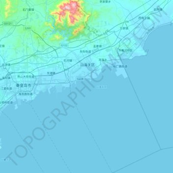
Name: 山海关区 topographic map, elevation, terrain.
Location: 山海关区, 秦皇岛市, 河北省, 中国 (39.76052 119.61608 40.11120 119.95285)
Average elevation: 102 ft
Minimum elevation: -10 ft
Maximum elevation: 2,966 ft
Other topographic maps
Click on a map to view its topography, its elevation and its terrain.