
北戴河区 topographic map
Interactive map
Click on the map to display elevation.
About this map
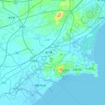
Name: 北戴河区 topographic map, elevation, terrain.
Location: 北戴河区, 秦皇岛市, 河北省, 中国 (39.66129 119.31300 39.91502 119.71716)
Average elevation: 30 ft
Minimum elevation: -10 ft
Maximum elevation: 1,030 ft
Other topographic maps
Click on a map to view its topography, its elevation and its terrain.