
白塔岭街道 topographic map
Interactive map
Click on the map to display elevation.
About this map
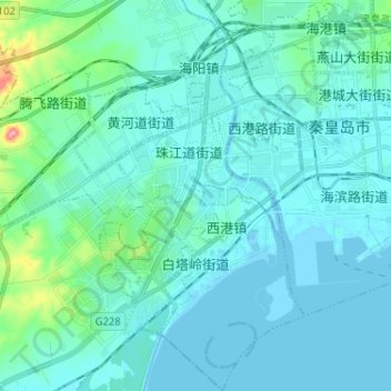
Name: 白塔岭街道 topographic map, elevation, terrain.
Location: 白塔岭街道, 海港区, 秦皇岛市, 河北省, 066004, 中国 (39.87244 119.51015 39.97121 119.57787)
Average elevation: 46 ft
Minimum elevation: -7 ft
Maximum elevation: 397 ft
Other topographic maps
Click on a map to view its topography, its elevation and its terrain.