
Kingston topographic map
Click on the map to display elevation.
About this map
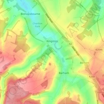
Name: Kingston topographic map, elevation, terrain.
Location: Kingston, Canterbury, Kent, England, United Kingdom (51.19578 1.09790 51.23135 1.17009)
Average elevation: 276 ft
Minimum elevation: 95 ft
Maximum elevation: 456 ft
Other topographic maps
Click on a map to view its topography, its elevation and its terrain.
Shalmsford Street
United Kingdom > England > Kent > Canterbury > Shalmsford Street
Average elevation: 177 ft
Reculver Country Park
United Kingdom > England > Kent > Canterbury > Hillborough
Average elevation: 33 ft